114612
Typical World Regional 20th Century - Map PowerPoint Template - Modelo do PowerPoint
ID: 11820
Desbloqueie este arquivo e obtenha acesso a outros recursos Premium
Torne-se Premium e Download! | Já é Premium? Entrar
Desbloqueie este arquivo e obtenha acesso a outros recursos Premium
Torne-se Premium e Download! | Já é Premium? Entrar
The regional approach to geographic analysis of the world was especially popular in the late 19th and early 20th century, and is associated with geographers like Paul Vidal de la Blanche, Carl Sauer and Richard Hartschorne. While regional analysis has largely been supplanted by other techniques in contemporary academic geography, classes in world regional geography remain common in higher education, albeit only in the United States (Rees and Legates 2013, 328). This is a typical world region map used in a textbook by Finlayson (2019).
-----------------------------------------------------------------------------
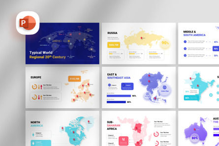
Typical World Regional 20th Century - Map Presentation Template is an asset to help you make the business illustration in the media presentation easier. With a variety of modern design choices, making your presentation structure easier to understand and stylist.
Easy to set and change colors according to your taste are the main features of this template presentation, because all elements are vector.
No graphic skills required.
-----------------------------------------------------------------------------
Included:
- Typical World Regional 20th Century - Map Presentation File
- Icon Pack
- Documentation
-----------------------------------------------------------------------------
Features:
- Each Template is 10 slides
- Full Responsive 16x9 HD Ratio Display
- Vector Shape All Elements
- Master Slide Options (Drag and Drop to Upload Images)
- Bonus Included: 1000+ Vector Icons as shapes
- Full & Easy Editable
- Creative & Professional Work
- Free font used
-----------------------------------------------------------------------------
Stock Photos are not included
----------------------------------------------------------------------------- Mais...
-----------------------------------------------------------------------------
Typical World Regional 20th Century - Map Presentation Template is an asset to help you make the business illustration in the media presentation easier. With a variety of modern design choices, making your presentation structure easier to understand and stylist.
Easy to set and change colors according to your taste are the main features of this template presentation, because all elements are vector.
No graphic skills required.
-----------------------------------------------------------------------------
Included:
- Typical World Regional 20th Century - Map Presentation File
- Icon Pack
- Documentation
-----------------------------------------------------------------------------
Features:
- Each Template is 10 slides
- Full Responsive 16x9 HD Ratio Display
- Vector Shape All Elements
- Master Slide Options (Drag and Drop to Upload Images)
- Bonus Included: 1000+ Vector Icons as shapes
- Full & Easy Editable
- Creative & Professional Work
- Free font used
-----------------------------------------------------------------------------
Stock Photos are not included
----------------------------------------------------------------------------- Mais...
Relacionados
Ocorreu um erro
Algo deu errado. É tudo o que sabemos por enquanto.
Por favor, atualize a página e tente novamente. Se o problema persistir, aguarde 30-40 minutos antes de tentar novamente. Agradecemos sua paciência.

